00 Sapp Street, STARKE, FL 32091


Active
Property Photos
Would you like to sell your home before you purchase this one?
Priced at Only: $130,000
For more Information Call:
Address: 00 Sapp Street, STARKE, FL 32091
Property Location and Similar Properties
- MLS#: GC528379 ( Land )
- Street Address: 00 Sapp Street
- Viewed: 9
- Price: $130,000
- Price sqft: $0
- Waterfront: No
- Year Built: Not Available
- Bldg sqft: 0
- Days On Market: 340
- Additional Information
- Geolocation: 29.961 / -82.1065
- County: BRADFORD
- City: STARKE
- Zipcode: 32091
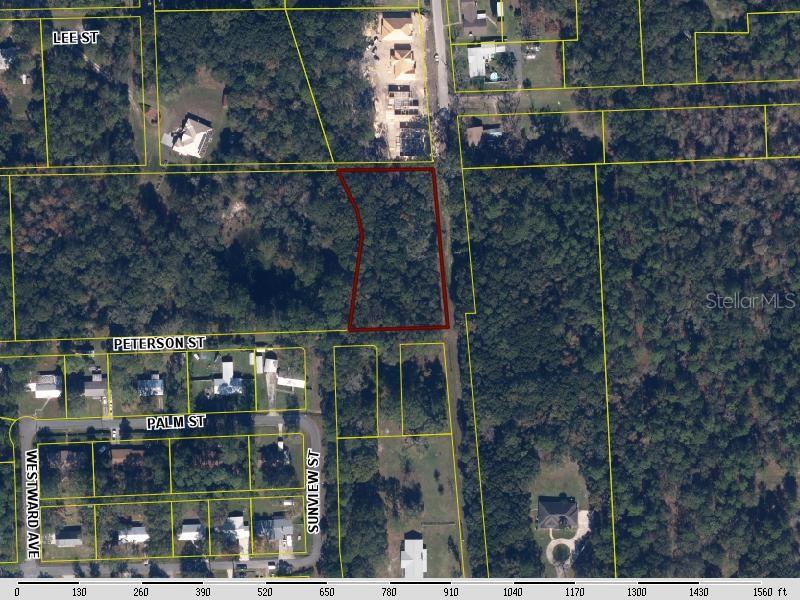
- Subdivision: Simon J Temples Sub
- Provided by: CB ISAAC REALTY
- Contact: Ronald Blake
- 352-475-2199

- DMCA Notice
-
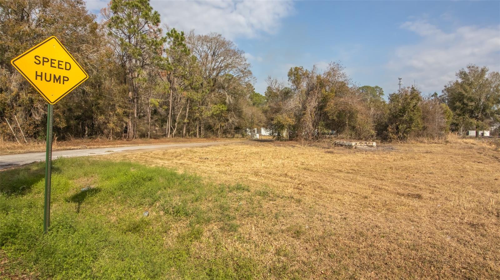
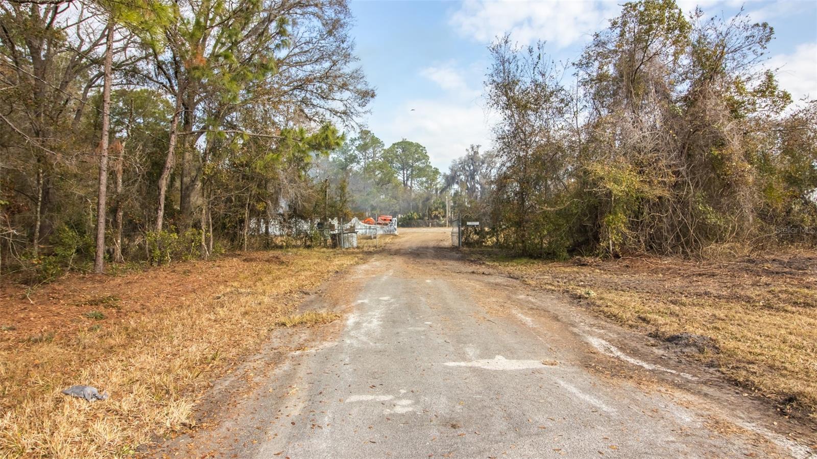
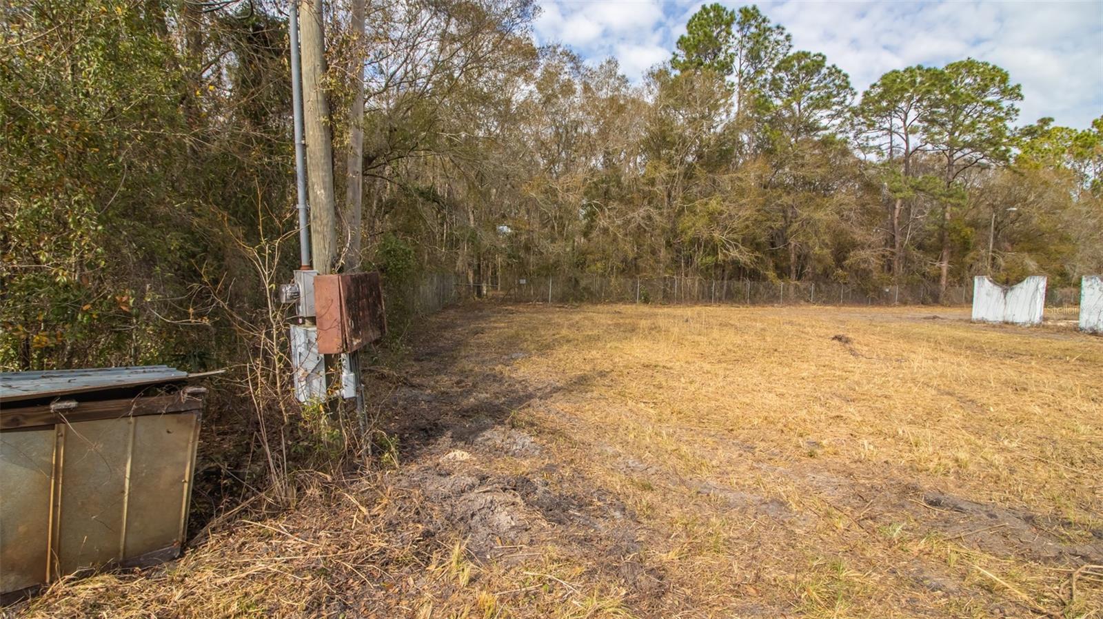
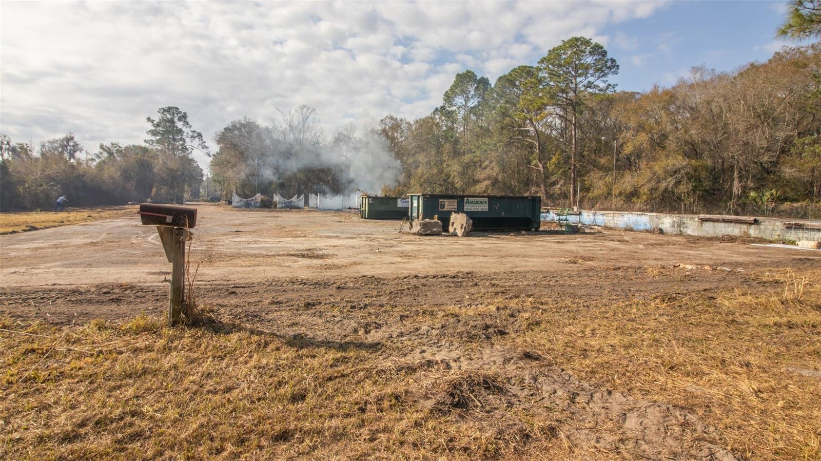
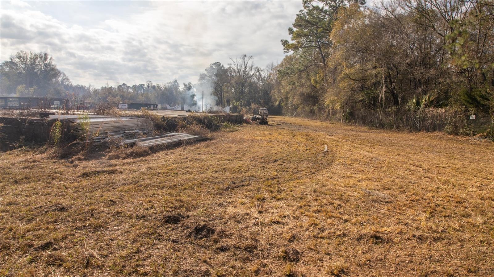
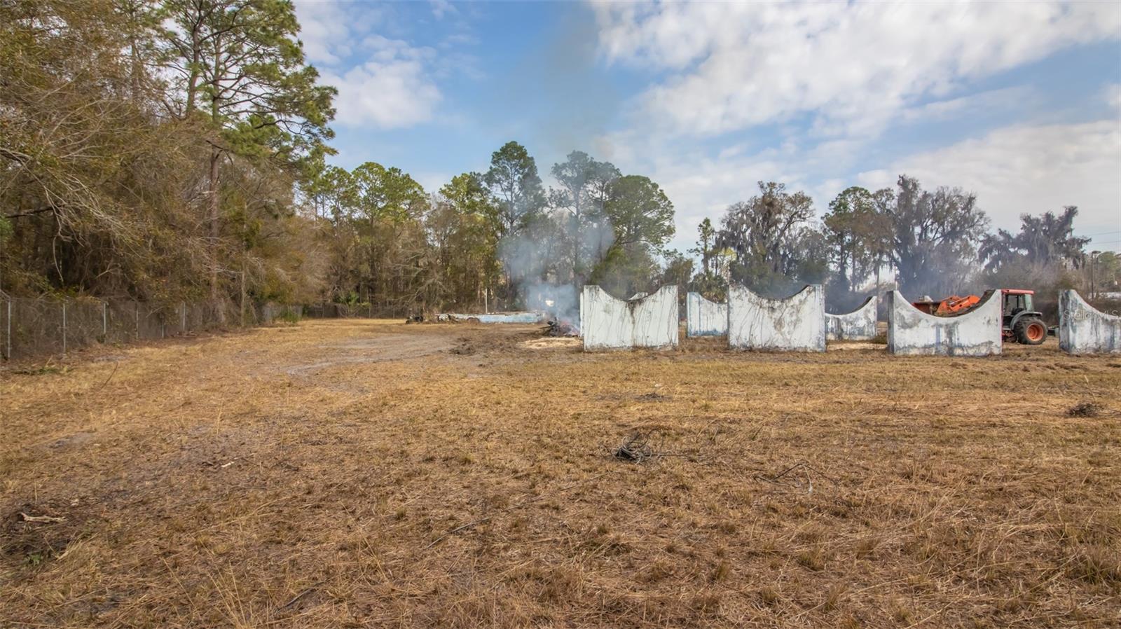
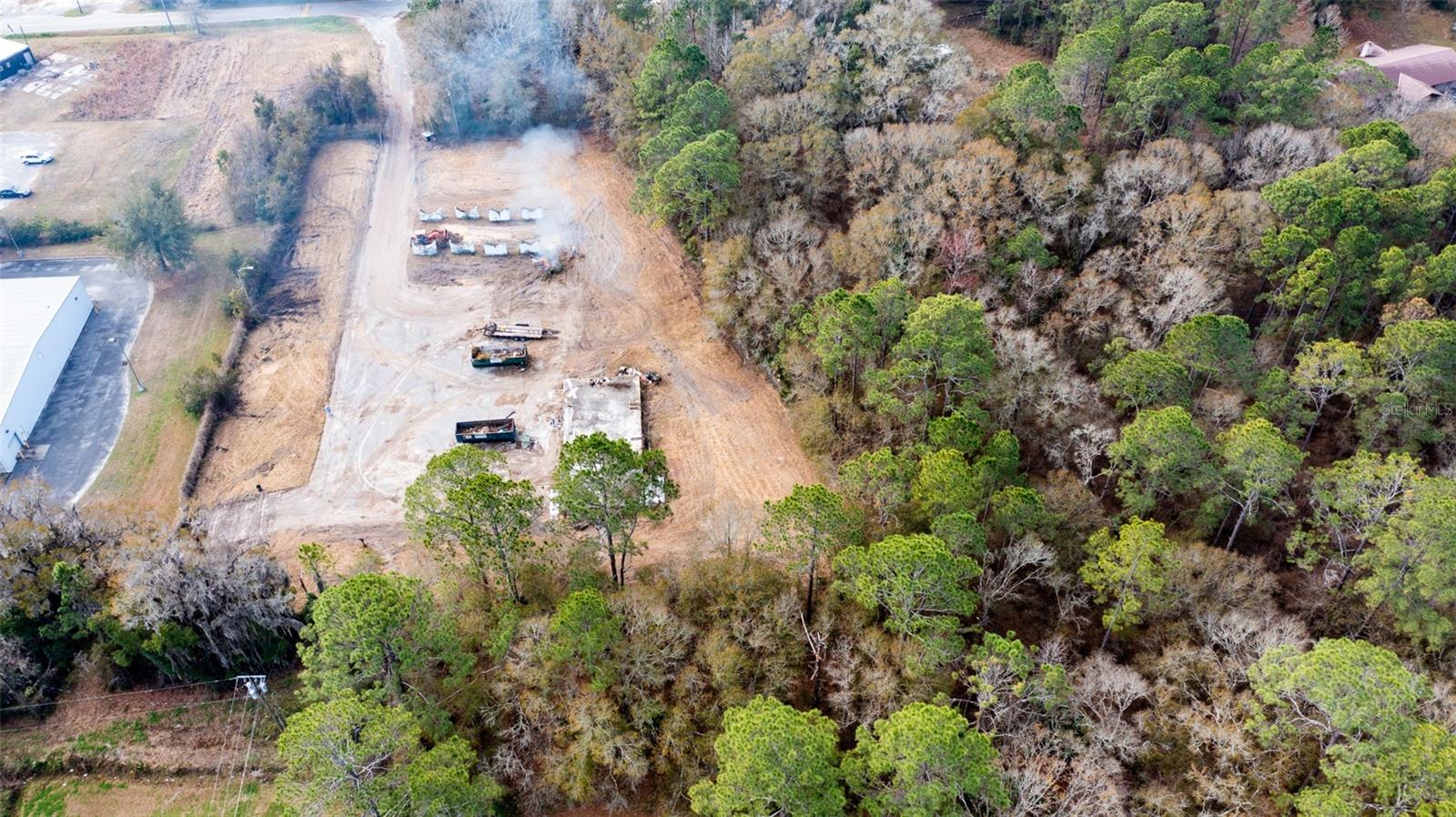
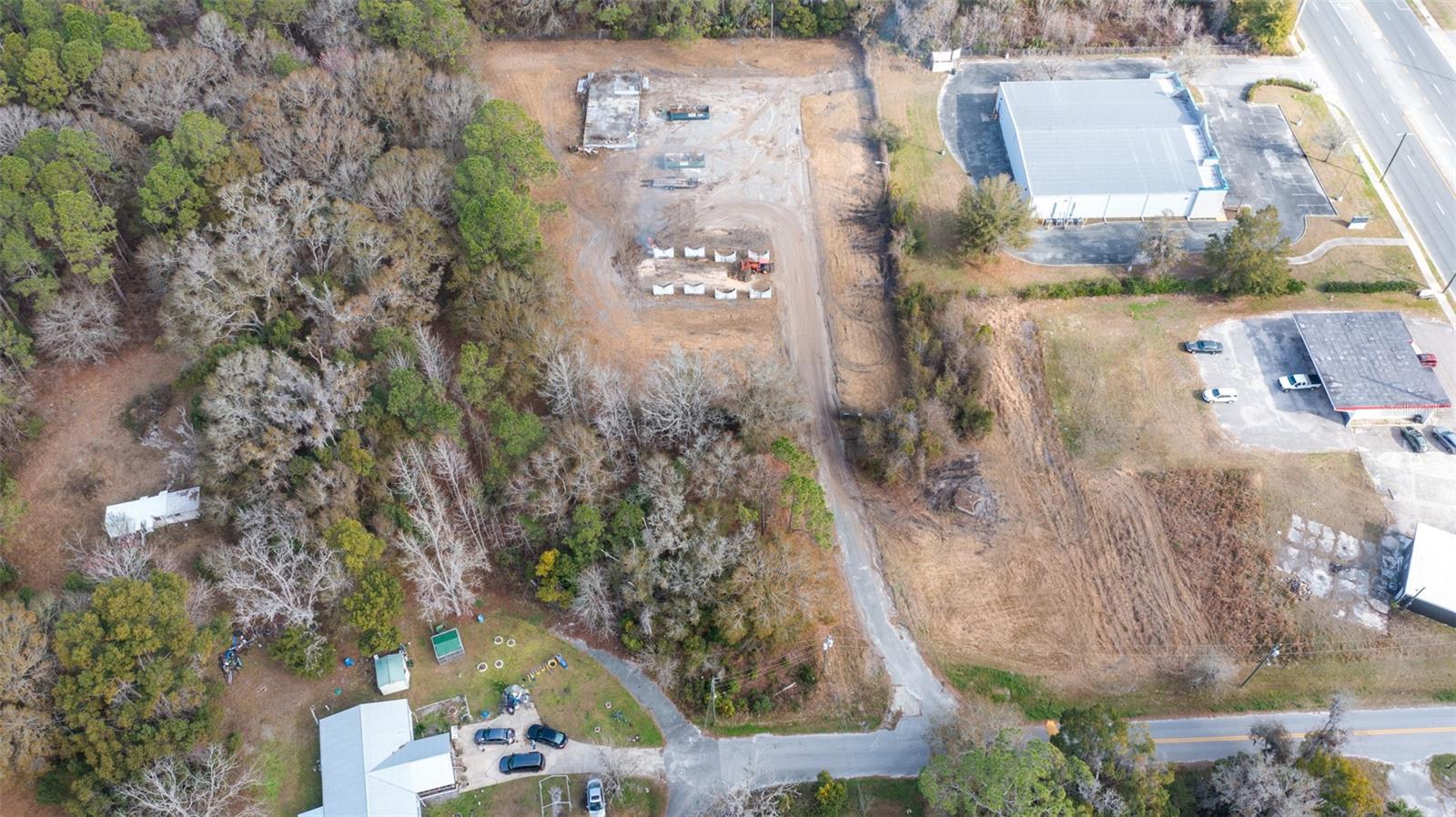
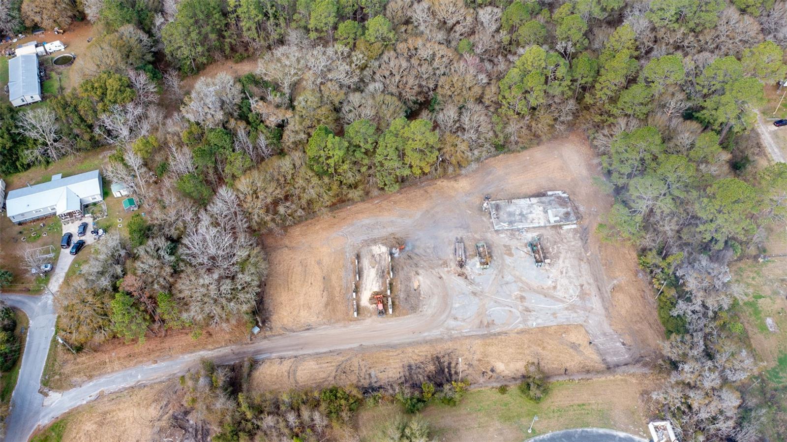
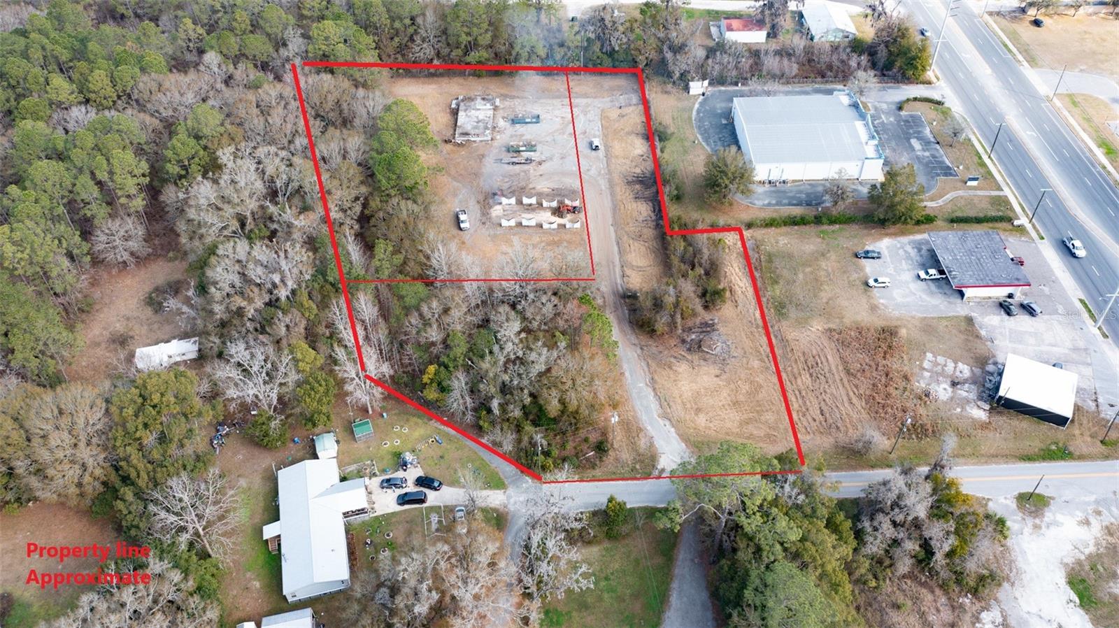
Description2 LOTS 1 SALE! Seller is selling parcels 02428 0 00200 and 02428 0 00102. When entering the property, this lot is zoned B3 Commercial Hwy (you can do pretty much anything with it), the second lot is zoned R1D Single Family/Mobile Homes. The second lot can more than likely be re zoned to B3 Commercial Hwy but not the other way around. These parcels are located within Starke City Limits. Seller believes there is power and water on the property.
Payment Calculator
- Principal & Interest -
- Property Tax $
- Home Insurance $
- HOA Fees $
- Monthly -
Features
Building and Construction
- Covered Spaces: 0.00
- Living Area: 0.00
Land Information
- Lot Features: Cleared
Garage and Parking
- Garage Spaces: 0.00
- Open Parking Spaces: 0.00
Eco-Communities
- Water Source: Public
Utilities
- Carport Spaces: 0.00
- Sewer: None
- Utilities: Electricity Available
Finance and Tax Information
- Home Owners Association Fee: 0.00
- Insurance Expense: 0.00
- Net Operating Income: 0.00
- Other Expense: 0.00
- Tax Year: 2024
Other Features
- Country: US
- Current Use: Mixed Use
- Legal Description: 21 6S 22 COM INT N LINE B3S R2W & W R/W SR-200. S17*46'30"W 474' TO POB. N72*15'W 557.89', THENCE S0*35"E 543.67', RUN S72*15'E 186.34', N17*46'30"E 225', S72*15'E 200' TO W R/W SR-200, N17*46'30"E 291' TO POB. BEING 4.56 ACRE M/L. EX: OR254-291 IN N W COR, BEING 1.49 ACRES. EX: COM SW COR SW1/4 OF NE1/4. N00*35'W 254.60', S72*07'34"E 168.81', N17*57'17"E 75.54' TO POB. N17*57'17"E 291', THENCE S72*15'E 266.09' TO W R/W OF HWY 301, S17*46'30"W 291', RUN N72*15'W 267.01' TO POB. BEING 1.78 ACRE
- Area Major: 32091 - Starke
- Parcel Number: 02428-0-00200
- Possession: Close Of Escrow
- Zoning Code: B3
Similar Properties
Active
$125,000.00
2 acres of undeveloped land inside the city limits of Starke. Sellers have had it surveyed and created 4 lots but have not filed with the property appraiser as yet and no individual parcel numbers hav
- Approx. 2.00 acres
- Provided by COLDWELL BANKER SMITH AND SMITH REALTY
- Contact Lisa Hull
-
- DMCA Notice
Nearby Subdivisions

- One Click Broker
- 800.557.8193
- Toll Free: 800.557.8193
- billing@brokeridxsites.com